Map
Sightings, the search radius, density circles, rare birds and the range map.
The map shows where the data on the top sheet comes from. Nearby draws the area it searched; a species draws where it was seen; Rare Bird Alert draws the rare sightings. Pop a sheet and the map goes back with it.
Sightings
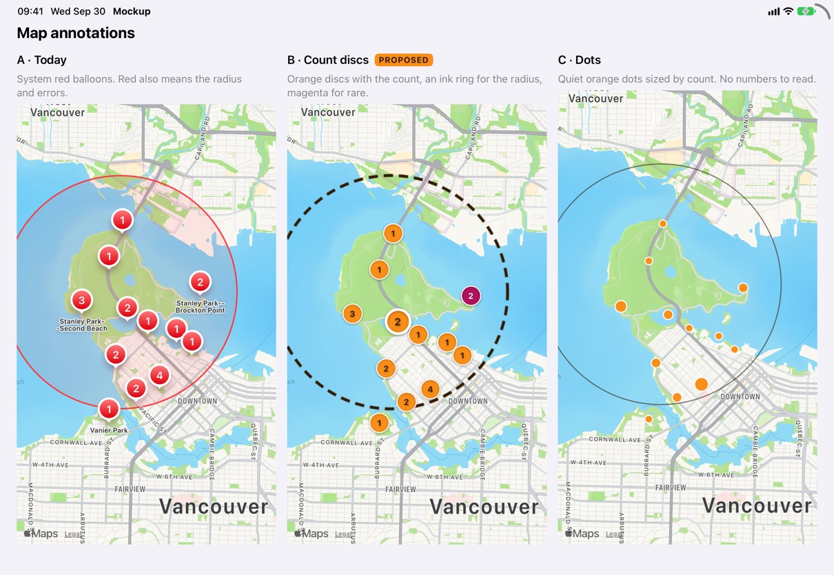
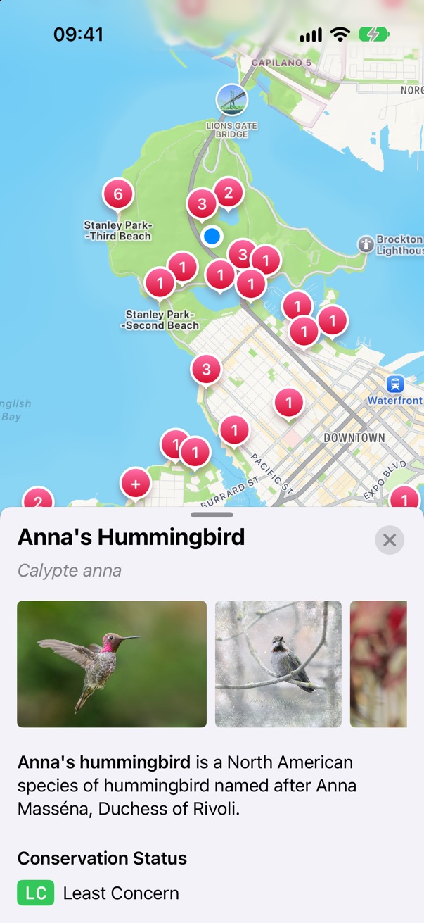
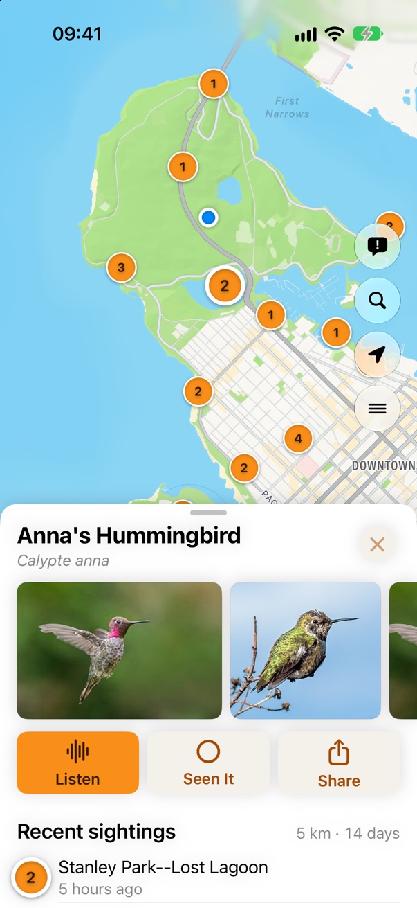
Today every mark on the map is the same system red: the search radius, each sighting, and the location warning badge. The redesign gives each one its own look. Sightings are orange discs with the bird count, the icon's sunset orange with its dark ink. The one you tapped grows and gets a thick white ring. Rare sightings are magenta. Red is kept for errors.
The search radius
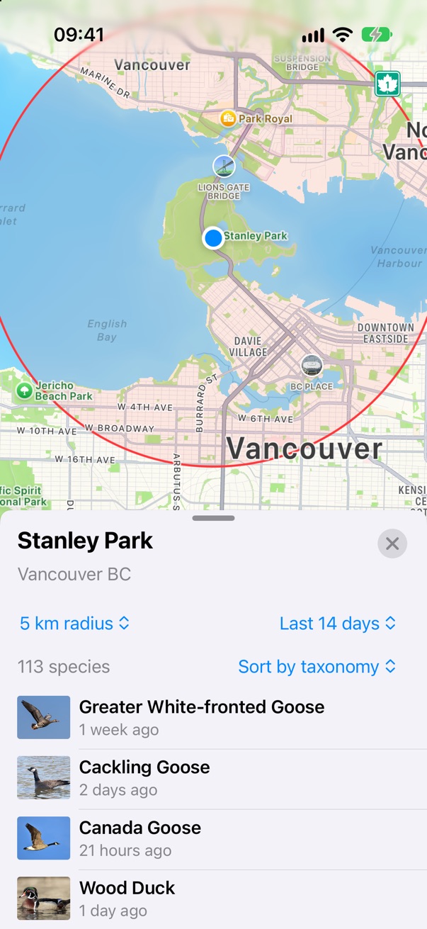
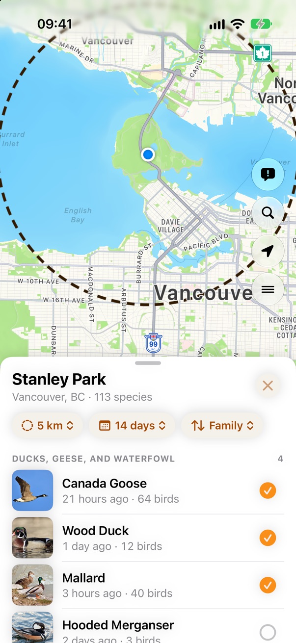
Nearby searches a circle around the place you're looking at. Today it is a red ring with a pink fill, the same red as the sightings one tap later. Proposed: a dashed ink ring with no fill, so it reads as a boundary, not as data.
Density circles
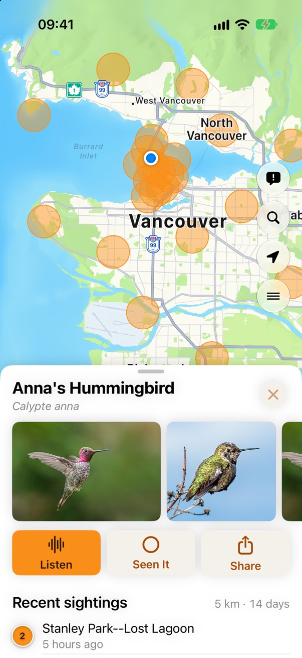
Zoomed out past 30 km with 20 or more sightings, one disc per sighting turns into a crowd. Each becomes a soft circle instead, so overlapping circles build up where the bird is common. Proposed: the same orange as the discs, at 45%, with a thin edge.
Rare Bird Alert
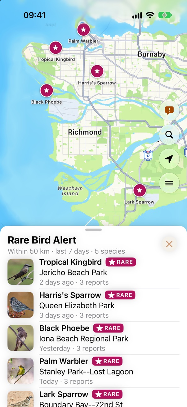
A magenta disc for each rare sighting in the region, the same magenta as the Rare tag in the list. Nothing else on the map is magenta.
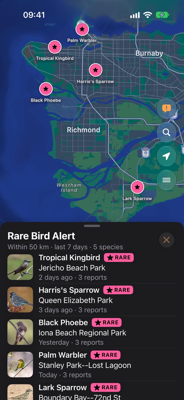
Range map
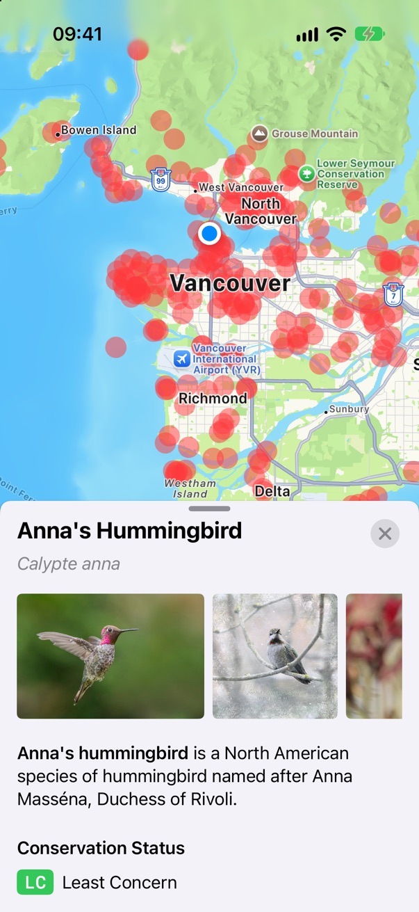
The app can already draw GBIF's occurrence map for a species, from every observation of the last five years, but nothing shows it yet. It answers "is this bird even found here?", which the 50 km of eBird sightings can't. These are that layer for Anna's Hummingbird, drawn from GBIF with the app's own settings. The built-in light style colours the densest cells white, so on a light map the heart of the range disappears; the classic style makes the densest cells the darkest and is proposed instead. It would show only when you zoom out past the sightings, never together with them.
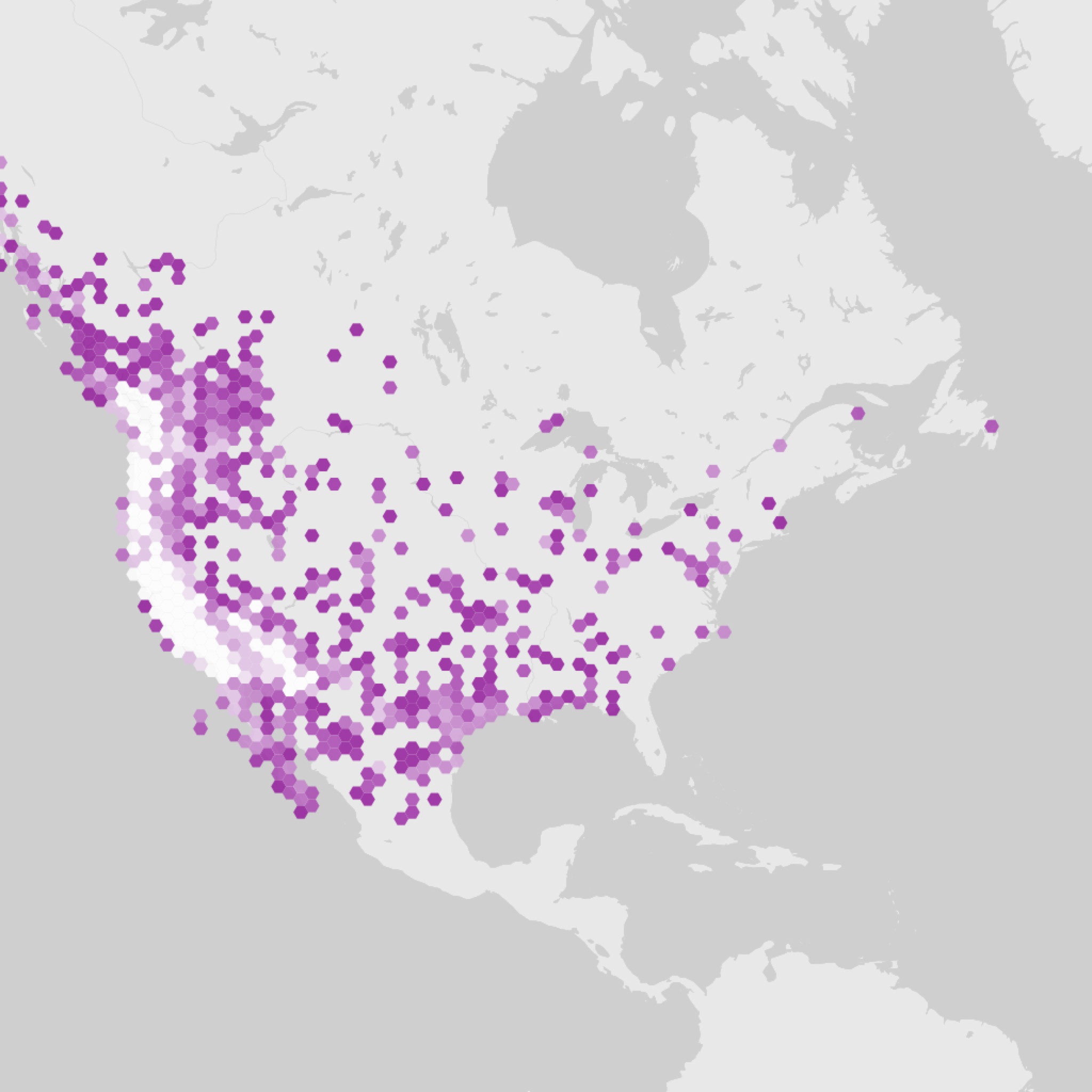
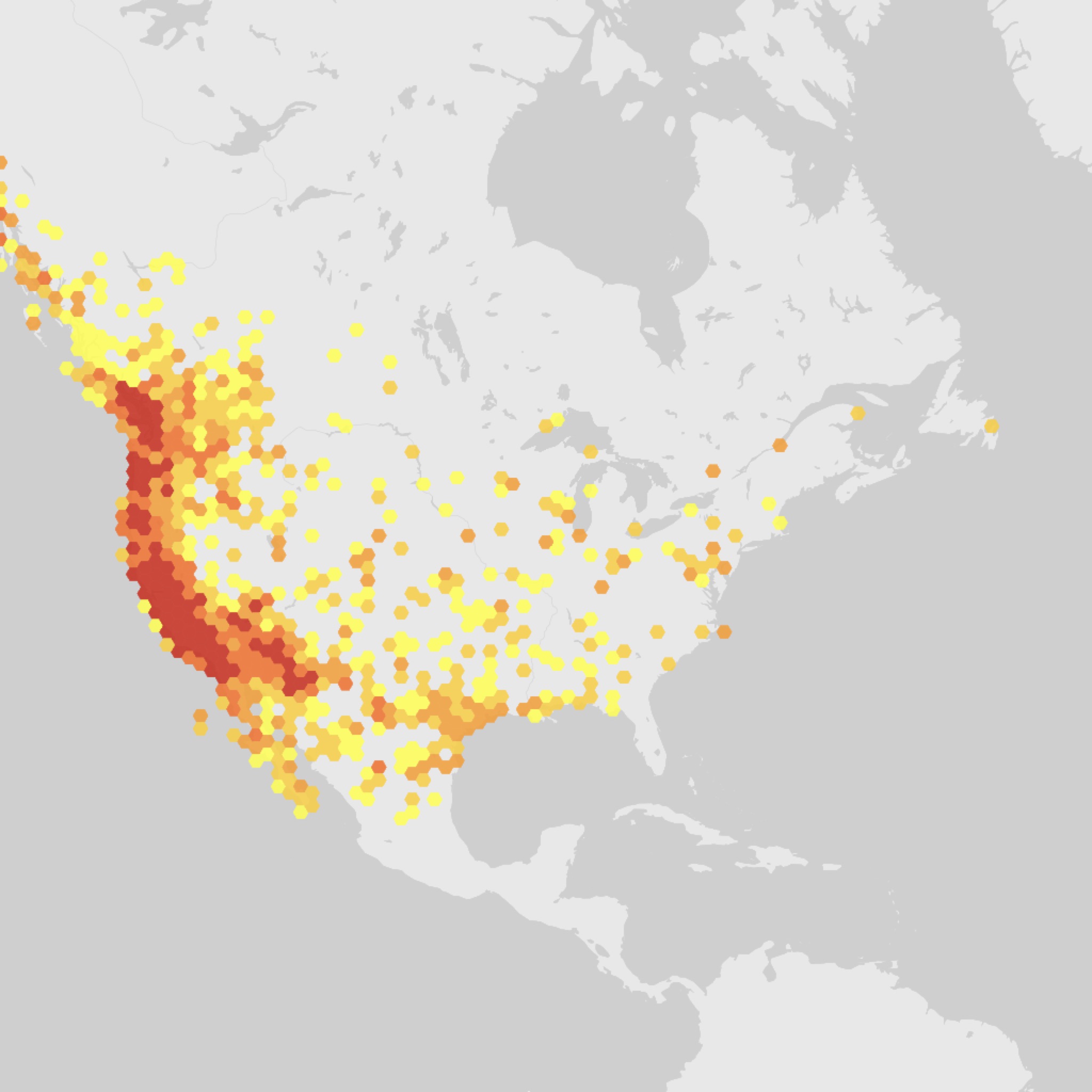
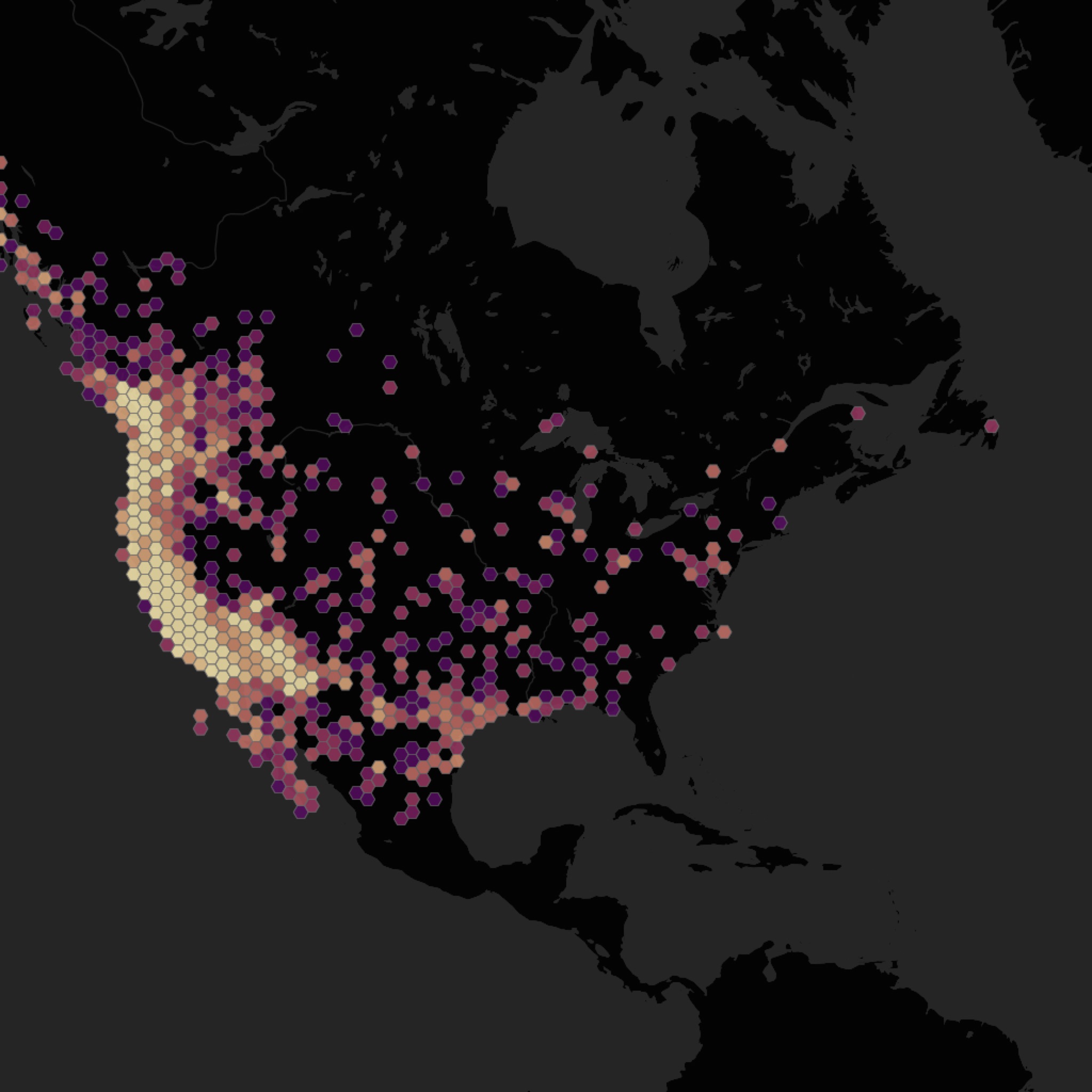
Range data: GBIF.org occurrence density, human observations 2021–2026.
Birds Near Me 2 • Send Feedback • Birds Near Me 1 • © 2026 Gerry Shaw